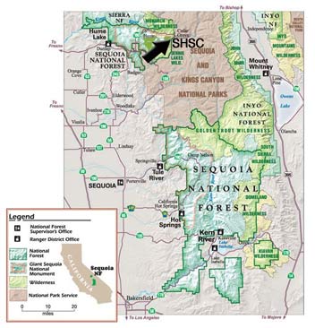
Located at the southern most end of the Sierra Nevada in Central California, the Giant Sequoia National Monument is located within the Sequoia National Forest on 327,769 acres of federal land. To further clarify, this area is on the west side of Kings Canyon National Park and the north end boundary of Sequoia National Park
Designated by President Clinton on April 15, 2000 by a Presidential Proclamation, the monument was established to recognize and permanently protect 38 groves of giant sequoias at the southern end of the Sierra Nevada Mountains.
The monument is managed by the United States Forest Service, under the U.S. Department of Agriculture, and includes rugged and scenic terrain that ranges from 2,000 to 10,000 feet in elevation.
The approximately 550 mile area is a lovely mixture of magnificent sequoia groves as well as giant redwoods, glacier-carved canyons, wide rivers, meadows filled with wildflowers, bold granite domes and spires. Also, the monument is rich with the history of Native Americans and turn of the century redwood logging operations (in nearby Hume Lake).
Please click on the map below to enlarge.